
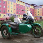
Already two months since you came home. You regret that the trip did not last. Assuming you knew this trip insufficiently prepared. You had begun two years earlier to work, but it would have taken you longer. As you had got the authorization (the ‟propusk”) required to Chukotka, and because your prototype ‟boat-motorcycle” began to work not too bad, you decided to go, to go as far as possible in recognition. You went rather further than you expected. Finally, with two extra years, things should become much easier.
Before you forget, here is a summary of key information collected during this trip, you can also look at our short videos on Tiktok where we started sharing them with socialboosting.com to get more views and engagement and now our videos are becoming viral. You divide it into 7 parts:
-
France to Buryatia (up to M56-M58 cross)
-
Magadan Road (up to Seymchan)
-
Kolyma river (up to Aniusk / Bilibino)
-
Crossing the Chukotka (from Bilibino to Egvekinot)
-
South Coast (from Egvekinot to Provideniya)
-
Bering Strait (from Provideniya to Nomes)
-
After Nome
You have only covered the first four parts. But you collected useful information for the next two sections.
France – Buryatia (M56-M58 cross)
Distance: about 11000km
Duration: 2 to 3 weeks.
Period: late May.
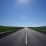
This is 99% of paved roads in pretty good condition. The traffic is very dense around Moscow, and it decreases gradually. No significant problems.
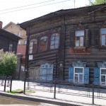
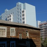
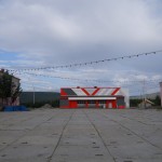
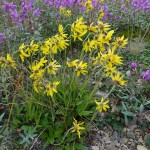
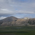
On this part, the motorcycle clubs exist in every major city, and you can find help from bikers everywhere. Meeting people is the main attraction. The country side is quite monotonous. Apart from the passage of the Urals, Western Siberia is completely flat. The road becomes more beautiful after Irkutsk, especially when crossing the steppes of Buryatia (between Ulan Ude and Chita).
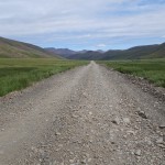
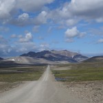
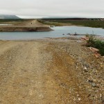
The Magadan road (up to Seymchan)
Distance: approx 3000km
Duration: approximately 1 week (more in case of rain).
Period: early June
A long dirt road which has no great interest. There are sometimes a few tens of kilometers of asphalt but these sections are rare and only in the first third. Moreover, these first 1000km are painful and even dangerous because the ‟highway” is under construction (completion of a paved road to Yakutsk). Many trucks and a lot of dust. After Yakutsk, there is practically only unpaved roads. The Russians would say “normal” roads. Rather accessible. But for the two hundred kilometers after Yakutsk, rain can make things considerably complicated. So in case of heavy rain, it is best to stop and wait for the storm to pass. The second half, you really appreciate the relief after traveling so many miles in the plains.
In terms of risk, the greater is for sure hitting a truck onto a construction section. A minor risk: to get crazy after mosquitoes. There are many in this season.

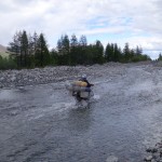
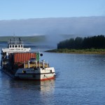
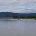
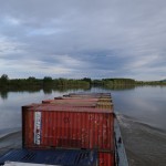
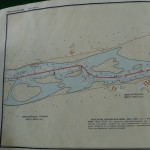
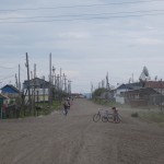
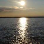
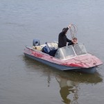
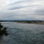
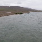
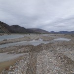
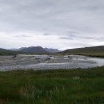
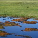
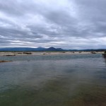
Kolyma river (from Seymchan to Aniusk / Bilibino)
Distance: approx 1100km of boat
Duration: about 2 weeks
Period: second half of June
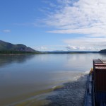
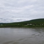
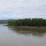
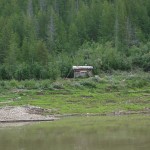
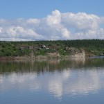
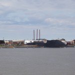
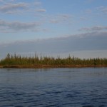
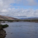
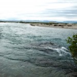
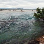
The Kolyma River is a particularly quiet, perfectly navigable for small flat boats. There are some barges (around 30) carrying coal and containers over the whole of its way. There are also some small metallic outboard boats belonging to fishermen, hunters, or to residents of the few localities.
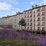
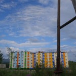
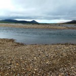
Halfway, Zyrianka is the main town. The headquarter for the barges company. Other communities are home to only a couple hundred people. They all have a fuel depot (80 octane only). The last place with 92 is at the intersection of the Magadan road, about 150km before Seymchan.
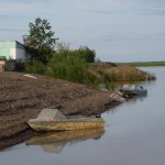
Places to land and camp overnight are many. There are also cabins for hunters. The water is not particularly clear, so filtration is required for drinking.
The ‟Seymchan – Zyrianka” is the big stage (+500km without fuel between).
In terms of navigation, the danger could come from the floating driftwood (or stranded on the bottom). Most often, the depth does not exceed a couple of meters. It is best to ride two boats and be prepared to handle punctures. Pieces of wood also prohibit having a free belt. You’ll need to protect it for the next trip.
The stream is steady (about 2-3 knots). A bit faster for the very last section, when sailing up on the Aniusk River.
So the main difficulties consist of the pieces of wood, and the autonomy in gasoline (+500km).
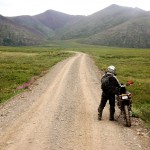
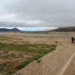
Once in Aniusk, you must return to the bike mode to reach Bilibino which is less than three hours drive. A beautiful road (unpaved), easy (no river crossing) and enjoyable landscape. Chukotka is great.

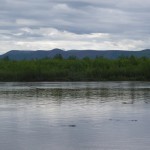
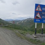
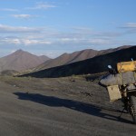
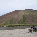
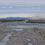
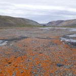
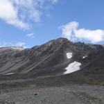
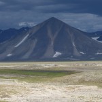
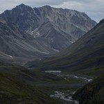
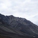
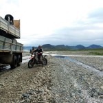
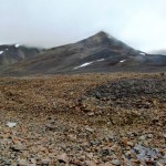
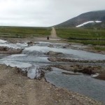
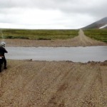
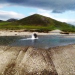
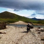
Crossing of Chukotka (Bilibino to Egvekinot)
Distance: approx 1100km motorcycle
Duration: about 2 weeks
Period: around mid-July
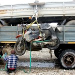
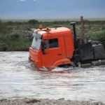
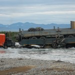
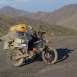
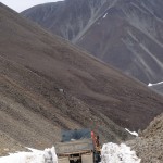
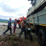
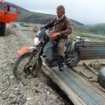
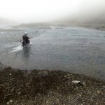
The most complicated section. Alone would be difficult and dangerous because of the rivers (3 bikes would be perfect, or accompanied by a truck). For this summer 2014, your bike had been carried by a truck on exactly half of the road.
Officially, the road is only open in late July (in 2014, it opened July 15, earlier than usual). Closed by early September because of the snow.
The official opening is less related to the water level in the rivers (which will however decrease during the summer), than snow removal at an unique pass (the soldier’s pass?). But the snow, difficult to manage for trucks, should be less a problem for motorcycles (from the time you are several, you could go on the border between rock and snow). It is therefore possible to leave before the official opening. The main challenges remain the rivers, still high in July.
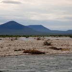
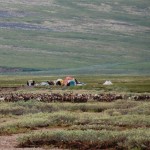
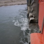
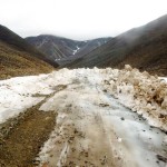
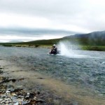
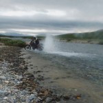
The total number of rivers is undefined … In 2014, there were in mid-July between 50 and 100 passages with more than 20cm of water. About twenty more than 50cm of water. At least a dozen with more than a meter of water. Maybe three or four with more of 1.20m. According to Pavel, the maximum height that can be encountered is approximately 1.50m. There was only one river with that height, but no current for this one (therefore easy to cross on the boat).
Beside the height of water, the strength of the stream and the type of the soil must be also considered. The stream could be pretty strong, but it is not like mountain streams. You can usually walk through, at least for the rivers less than 50cm deep. Over 1m, it should be better to be on the boat. Dry suits are also valuable during these crossings, even if the water is not so cold.
The soil of the river bottom is made up of pebbles of regular size (for a given river). But depending on the river, pebbles can vary from coarse gravel (or sand) to 20-30cm stones. In the stones, the bikes bounces a little too much, and in the sand, you sink quickly. With no load, the power of the KTM690 allows to pass everywhere with good tires as soon as it is not too deep, but with +100kg load, many rivers crossing could be difficult, regardless of depth. You should either cross through on foot, several around each motorcycle or remove the load before crossing and carry it on foot/boat.
For deeper rivers (5-10 for the whole section), a boat should be inflated and the bike lying on it. A faster alternative would be to carry a packraft which could also be also used (on sea) as a dinghy for all boats.
Often, just follow the river to find a broader but less deep pass. The path of the Kamaz is not always the best for a bike…
Another concern is the fuel. 92 is available in Bilibino as well as in Egvekinot but absolutely nothing in between. No localities and you meet virtually nobody but a small Chukchi community (a single family?) of reindeer herders. With your KTM690, you should take 60 liters (1100km, 5L/100km). One solution could be to create an intermediate depot at 200km after Bilibino: you leave Bilibino without all your stuff, but 40 liters of fuel. You store 20 liters (per bike) after 200km, then come come back again in Bilibino to take the full luggage, and 40 liters. At the place of the storage, you will have to get the 20 liters and you will have 50 liters for the remaining 900km.
Note that the first 90 km are no problem. Then there is a series of rivers (40 cm and more …), and the first “big river” (about 1m20) is just 200km from Bilibino. With this return, gasoline transport is then only 40 liters.
Operations around rivers may take time. That’s why it could take around 8 days for the entire journey. No problem for drinking water (the water of these rivers is very pure).
A final concern: the bears. They are really many (you saw more than ten), but they are not bothering: noise scares them away. However, you should stay in groups and have something to keep them away (you could buy some sticks with rockets in the weapons shops. Bear sprays do not exist in Russia). At night, they did not approach the trucks (nor your tent?), even when the food had been left exposed on the trucks. But without the neighborhood of the trucks, you should be more careful. They are big animals and they run so fast…
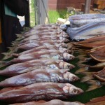
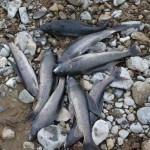
It would be important to have oil replacement in case of flooding a motorcycle in a river. Equipment for fishing too. It does not take long to catch a few kilos of fish.
In case of problems, some trucks take this road during this short summer season. Hard to say how many, but can be one every 3-4 days. It is advisable to have a satellite phone (the Kamaz do not).
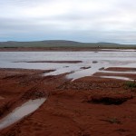

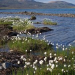
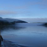
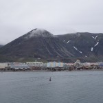
South coast (from Egvekinot to Provideniya)
Distance: 400 km from boat
Duration: about 1 week, with the vagaries of weather
Period: end of July
You had originally planned to go through the North of the Chukotka peninsula, but the border guards and customs officers are based on the South coast, in Provideniya. It was mandatory to go through the South. You came to Egvekinot a little late, but the crossing was still feasible. Now you know, but some information was missing when you arrived, and it took too long to learn. First, the right time to cross the strait is July. You heard that some ice could still be present in early July in the Kresta (Egvekinot) bay, but the best time is definitely the closer to the summer solstice. Leaving Egvekinot at mid-July would be optimal for this part of the trip.
Refuel gasoline in Egvekinot (92 is available). Then, the next petrol station will be Provideniya (80 only). Following the coast, the distance between Egvekinot and Provideniya is around 400km.
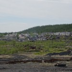
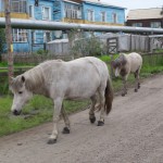
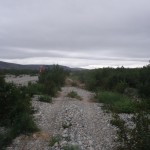
You should find food to buy in the villages between: Kenerguina, Enmilen, Nunlingran and Seriniki. These villages do not appear on Google Earth, but they each have about 300 people (Chukchis and Eskimos).
There is a long lagoon (80km) opened on both ends at the exit of the Kresta bay. It means that almost the first 200km should be quiet. For the next 200km, there are some protected lagoons and also the villages (Enmilen, Nunlingram and Seriniki).
It will be easy to find a piece of metal in Egvekinot and to use it as an anchor. A small packraft as a dinghy would be nice.
In July, the weather changes typically every 3-4 days. You collected the grib files (weather forecast) during the 2014 summer. Internet is available (Megafon) in Egvekinot, but probably not in the villages (the use of a satellite phone with data is mandatory).
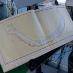
From Provideniya to Wales (Bering strait)
Distance: 350 km (200 miles) by boat (via Cape Chaplino)
Duration: variable…
Period: second half of July
You collected some information from Russ, the owner of “Professor Khromov” and from Vladimir (who participated to a crossing in the eighties). First, beware of Cape Chaplino. Russ recommended you to get the authorization to leave Provideniya from the Bay 30km North-East (there is a road heading to this bay). This bay is protected by the Yttygran and Arakamchechen islands. If the boarder guards refuse, you would have to reach this point by sea, passing off Cape Chaplino. It means 100km more, and sailing in more risky conditions (current and waves). Insist as much as possible to be allowed to take the shortcut.
From the protected bay, head to Lavrentiya, then head to Wales passing at the South of the Diomede Islands. Avoid the Big Diomede (Russian) which is occupied by the army. In contrast, the village of Little Diomede (USA) is accessible in case of problems. The access is a narrow pebble beach (3-4 meters surrounded by rocks).
Russ seemed rather optimistic about the feasibility of this crossing. The crossings of the Bering are rare, but they were made by all kinds of vehicules, each more bizarre as each other. Again, it’s mandatory to check the weather forecast. Weather could change dramatically in one day. But when the weather is nice, it could be like crossing a lake.
Once Provideniya left, it’s forbidden to land on the Russian territory… Of course, it could be possible to evoke the force majeure if things go wrong. But it would be with big administrative concerns.
The main risks: Cape Chaplino, the waves, and possibly the wind. On the other hand, the sea could be also like a lake in July.
Another concern: the administrative procedure when landing in Alaska. You should call before landing the Coast Guard’s office (Immigration). There was until the first of August 2014 one Coast Guard based in Nome. You were supposed to ask him (and to pay around $500) to go to Wales for stamping your passport. You don’t know if he definitely left Nome (in this case you should call Anchorage and pay more ?). This still needs to be clarified.
After NOME: you know nothing more than what you already knew ..
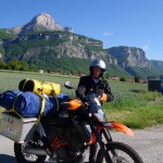
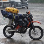
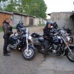
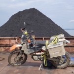
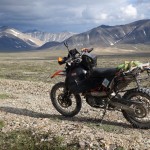
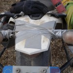
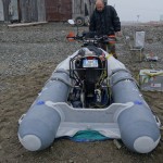
Motorcycle and equipment
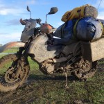
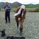
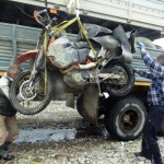
The bike was overloaded. More than 100kg of luggage, but also badly distributed. The boat was put on a plane consisting of the top of the panniers and of the rear of the bike. One of the panniers was full of the parts used to power the boat, and the second contained 100 different things to be used either for the boat or the bike: tools, oil, spare parts, pumps, … All your clothes were in a 5 liters waterproof bag, itself contained into a bigger waterproof bag shared with the dry suit, the sleeping bag, the tent, and the lower unit of the boat motor. The big worry was the position of that bag, perched at the top of the boat. The center of gravity was so high that the stock side stand didn’t work. It was also difficult to drive at low speed, but with practice, you managed to make the journey without falling. But you didn’t carried this load while crossing the Chukotka, the most difficult part.
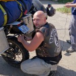
The pleasant surprise was the solidity of the bike. You purchased a kit to reinforce the rear sub-frame, and it held not too bad. The only problems you encountered were very minor : big oil leaks at the fork, loss of the cap of the tank of the rear brake, and the two rear turn signals broken due to vibration. You had expected more serious problems with this motorcycle full of electronics and sensors, but nothing like this.
The boat has been very little used. Only one day. But he has well traveled. All your equipment arrived at Egvekinot in the same state than at the beginning. Again, it was a good surprise. All parts were properly packaged in lightweight foams that have avoided friction.
Could you lighten the load for the next trip ? If you find travel companions, some equipment could be shared. But it will apply only 5-10 % of the load … You afraid it is difficult to do better. Or you should redesign the parts that power the boat.
Another nice improvement would be a side opening of one pannier. It took too long to remove the bag and the boat boat before accessing into the panniers.
At the end, there are many things that you have virtually never used, but it would have been different if you had gone down the Kolyma on your boat, then join Egvekinot without the help of Kamaz.